Cupid 13,117'
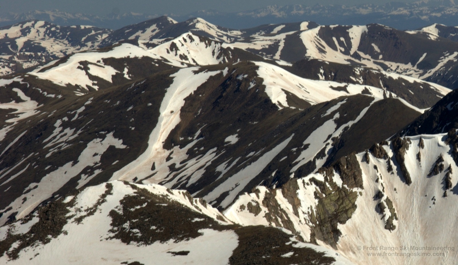
Cupid from the east. Photo: Rob Writz
Cupid sits on the Continental Divide between Grizzly Peak and Mount Sniktau. The mountain climbs over 2,000 feet from the north parking lot at the Arapahoe Basin Ski Area to the summit. Cupid is a great peak for aspiring ski mountaineers to climb because it allows for a longer day at a higher altitude, but remains close to the trailheads. Many cars pass this peak as they drive up or down the south side of Loveland Pass. Many Front Range ski mountaineers climb or ski Cupid as it is a major peak along the ridge ultimately leading to the 14er Torreys Peak. Dave’s Wave on Cupid is frequently used as an exit route for skiers who are exploring the North Face of Grizzly Peak and the Southeast Face of Cupid. Plan on at least two runs when you are in this area. One run on the east side of the Continental Divide, and Dave’s Wave all the way to Arapahoe Basin!

Shared Approach from Loveland Pass
Front Range Ski Mountaineering advocates climbing the ski route before descending it. However, there are routes on the Front Range that locals commonly approach from another direction. The three routes described on Cupid are frequently approached from Loveland Pass. A ski descent of Cupid’s Kearney Bowl and Southeast Face will require a climb back up to the Continental Divide to exit to Highway 6.
From the Continental Divide at Loveland Pass, climb east up the ridge line 1.6 miles to the summit of Cupid. The first eight tenths of a mile will take you to a small peak (Point 12,915’) on the ridgeline that connects to Cupid and Grizzly to the south. Head south and downhill to the saddle between Point 12,915’ and Cupid and climb to the summit of Cupid. While on the ridge the skier’s right side will usually be severely wind scoured and the skier’s left side will be a line of cornices.
Route 1 - Southeast Face
- Rating: II D4
- Season: Spring
- Exposure: Southeast
- Vertical: 900'
- Approach Elevations: 11,990' - 13,117'
- Approach Distance: From Loveland Pass TH: 1.6 miles
The Southeast Face of Cupid is a great destination for the aspiring ski mountaineer. This route allows for high altitude, a descent directly from the summit, and close proximity to the access roads. The majority of the descent is moderate, but there are a few initial steep turns. You can ski far into Grizzly Gulch before reaching tree line. If you approach from Loveland Pass without a shuttle in Grizzly Gulch you will need to climb back up Cupid and ski Dave’s Wave or the ascent ridge. To do this, regain the flat plateau below Cupid’s southeast face and climb directly west to the 12,756’ saddle between Cupid and Point 12,936’. You can skin most of this climb.
Route 2 - Kearney Bowl
- Rating: II D4 - D6
- Season: Spring
- Exposure: North, Northeast
- Vertical: 800'
- Approach Elevations: 11,990' - 12,800'
- Approach Distance: From Loveland Pass TH: 1.4 miles
Kearney Bowl hosts several descent lines on the north side of Cupid and the south side of Point 12,915’. For the most part the ski descents in the bowl are moderately steep, but there is a steeper section in the middle of the bowl guarded by an overhanging cornice. Similar to the Southeast Face, a ski descent into Kearney Bowl will result in a climb back out to the Continental Divide and then a descent of Dave’s Wave or one of the routes from Point 12,95’. The most likely re-ascent is climber’s left to the summit of Cupid or to the saddle between the summit and Point 12,195’.
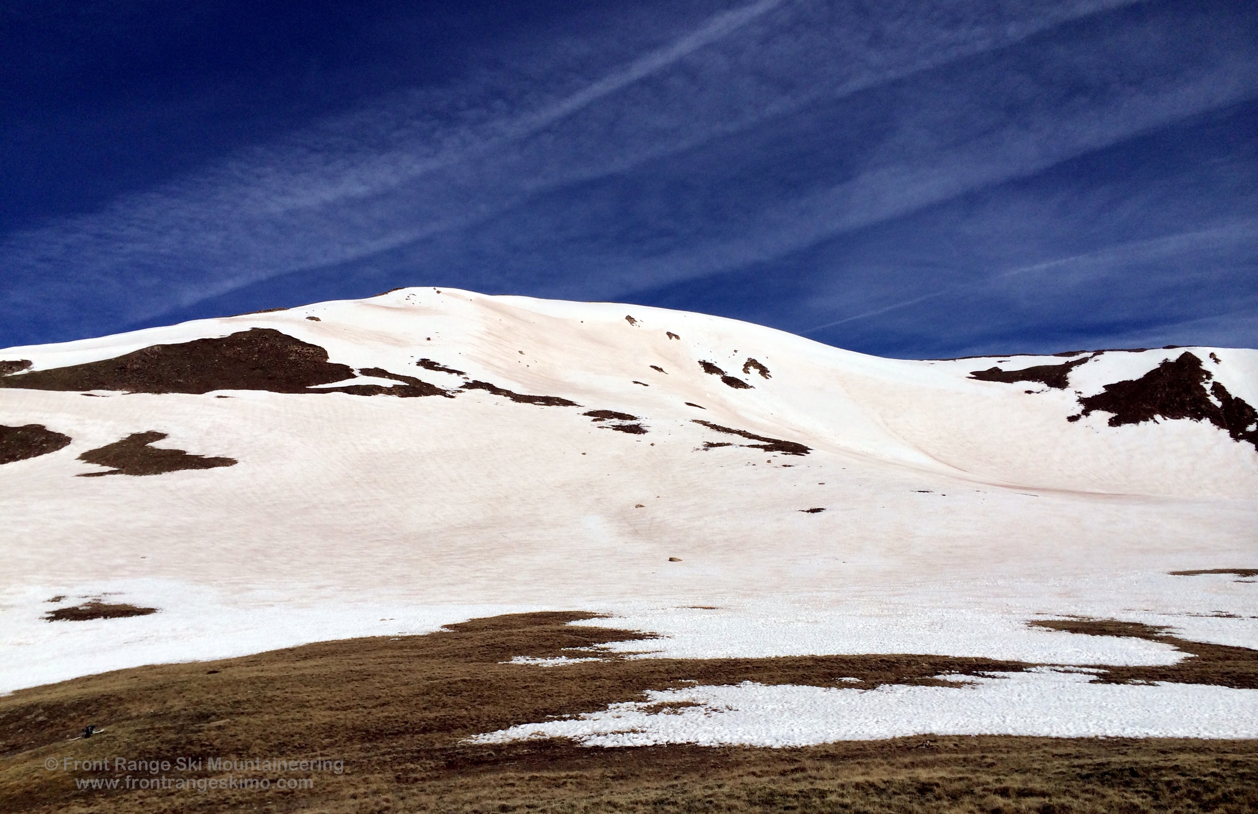
Cupid from the South. Photo: Rob Writz
Route 3 - Dave's Wave
- Rating: II D5
- Season: Spring
- Exposure: South, Southwest
- Vertical: 1,920'
- Approach Elevations: 11,080' - 13,000'
- Approach Distance: From Loveland Pass TH: 1.6 miles, From A-Basin North Lot: 1 mile
Dave’s Wave is the popular route from just below the summit of Cupid to the Loveland Pass Road. It is also frequently used as an exit descent for skiers who have climbed out of Grizzly Gulch from a descent of Cupid’s Southeast Face, Point 12,936’, or Grizzly Peak’s North Face. The Wave is in the upper portion of the route and is formed by the leeward deposit of snow from a small ridge that is oriented north to south. The elevation drop from the top to Arapahoe Basin north parking lot is nearly 2,000 feet and the snow conditions can vary dramatically from above tree line to below tree line. The skiing at the top is lower angled and you can “surf” the wave. Lower down route the skiing in the forest is steeper and more complex as Dave’s Wave turns into a creek bed and small ravine. Ski on the sides, or traverse above tree line into the bottom of the “Sleeper’s 2” chute.
There are two approaches to Dave’s Wave. The first approach is to follow the brief description in the “Shared Approach from Loveland Pass” to the summit of Cupid and then drop west and downhill to the start of the route. A second approach is to park at the A-Basin north lot and skin north across flatter terrain and then enter the forest to climb east. Climb up the sides of the drainage exiting Dave’s Wave, or follow the chute exiting the “Sleeper 2” chutes to the south (looker’s right) and then traverse to Dave’s Wave.

Loveland Pass Trailhead (11,990’)
Loveland Pass Trailhead is the parking lot at the top of the pass. The top of the pass is on Highway 6 and is 3.9 miles from the Loveland Ski Area on Interstate 70 and 3.7 miles from the Arapaho Basin Ski Area. Park on the east side of the road. Make sure to have your car well off the road as many cars and trucks pass through here.

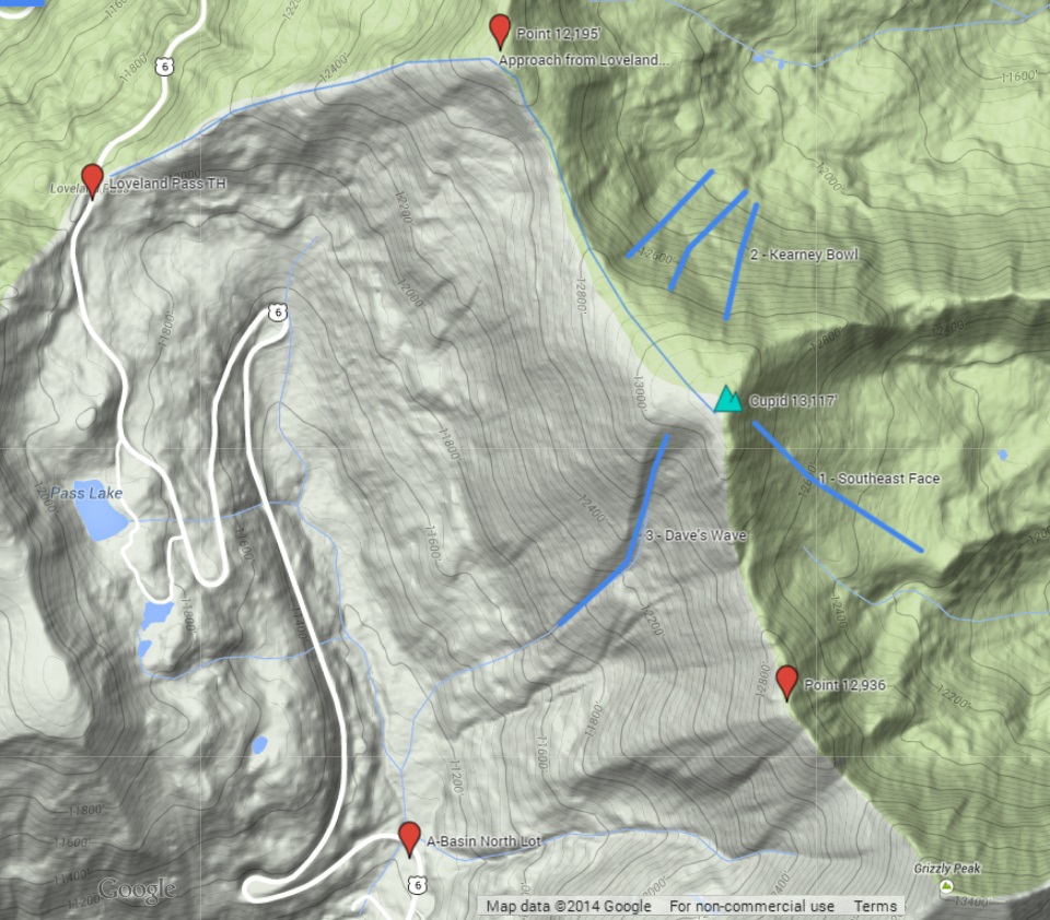
Clicking on map above will open interactive Google map website