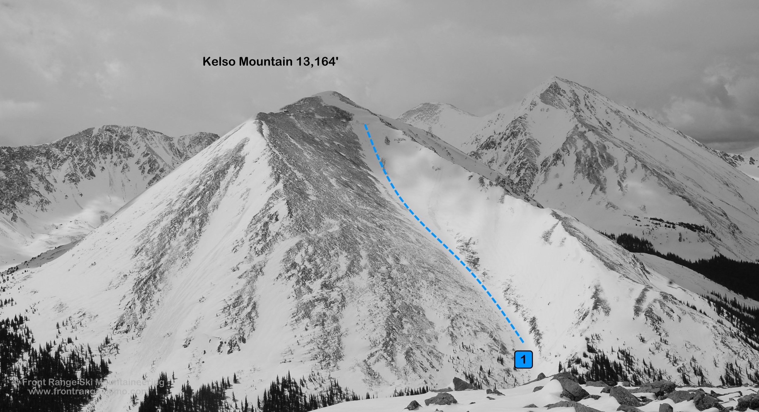
Kelso Mountain 13,164'
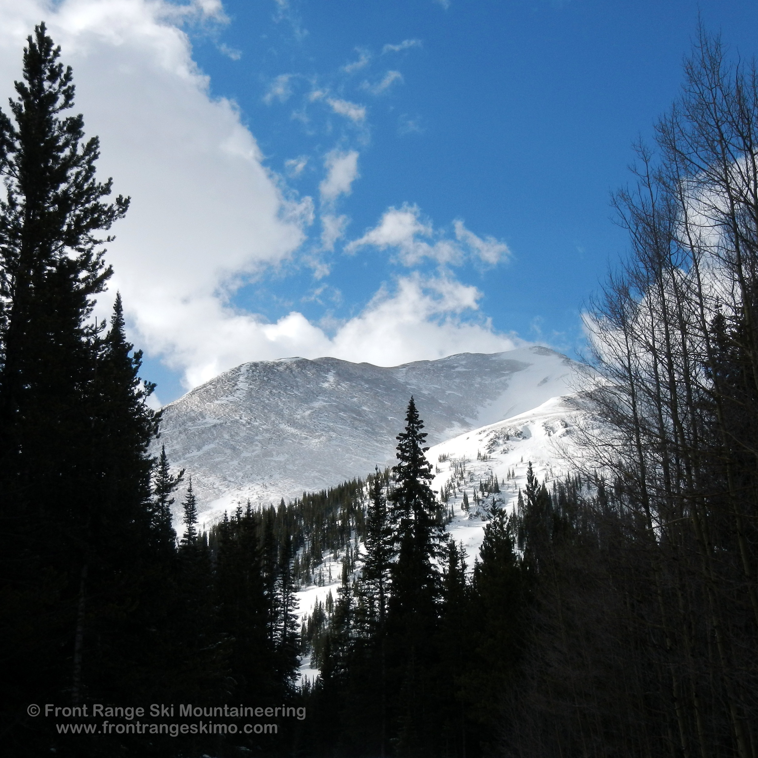
Kelso Mountain from the north. Photo: Rob Writz
Kelso Mountain is the gateway to the Stevens Gulch and Grizzly Gulch ski mountaineering arena. Kelso is positioned in the middle of these two major gulches and the summit provides climbers and skiers with stunning views that will provide inspiration for future adventures. The North Gully on Kelso is one of the more frequently skied routes on the Front Range. This peak is positioned close to Interstate 70 and the approach can be quick, but be prepared for a big climb of over 2,000 feet to the summit! The north side of Kelso including the North Gully is on private land, but access in the winter and spring has not been an issue to date.
+ ROUTES
1 – North Gully
- Rating: II, D5
- Season: Spring
- Exposure: North
- Vertical: 2,365'
- Approach Elevations: 9,800' - 13,164'
- Approach Distance: From Stevens Gulch TH: 3 miles
The North Gully is one of the more popular ski descents on the Front Range. Quick access, great views, and the potential to ski to near a car parked on the Stevens Gulch road are several of the appealing aspects of Kelso’s North Gully. The western side of this large bowl is a leeward slope that catches and deposits snow into this shallow chute. The eastern side of the bowl is a wind scoured face that rarely holds snow. The chute itself is a straight forward climb and ski. It is a summit ski descent, never too steep, easily accessible, and the north aspect can hold the snow condition for a descent later in the morning or early afternoon.
At about 1.75 miles from the Stevens Gulch Trailhead at the Bakersville you will pass the avalanche scour of the North Gully. You can descend here to access the couloir, but you will have to ford the creek. You can also proceed several hundred feet up the road to access via a mine road. Pass a building on your right and then the road appears. This road will cut back to the chute. Climb the chute, the windswept side, or the ridge on the right to the summit.
+ TRAILHEAD
Stevens Gulch - Bakersville Exit (9,900’)
Stevens Gulch Trailhead is accessed via Exit 221 on Interstate 70. This is the Bakersville exit. Exit the interstate and proceed south to Road 321 (Stevens Gulch Road). Early in the spring during a good snow winter you may need to park just south of the interstate where the Stevens Gulch road turns east. There is a sharp turn to the west just up the road from here that is frequently blocked with snow. During the spring the snow on the road rapidly melts and the distance from this trailhead to Kelso Mountain will vary significantly.
+ MAPS & PICTURES
Below we have included a link to a Google interactive map and a curated list of photos of the mountain.

Clicking on map above will open interactive Google map website