Mount Machebeuf 12,805'
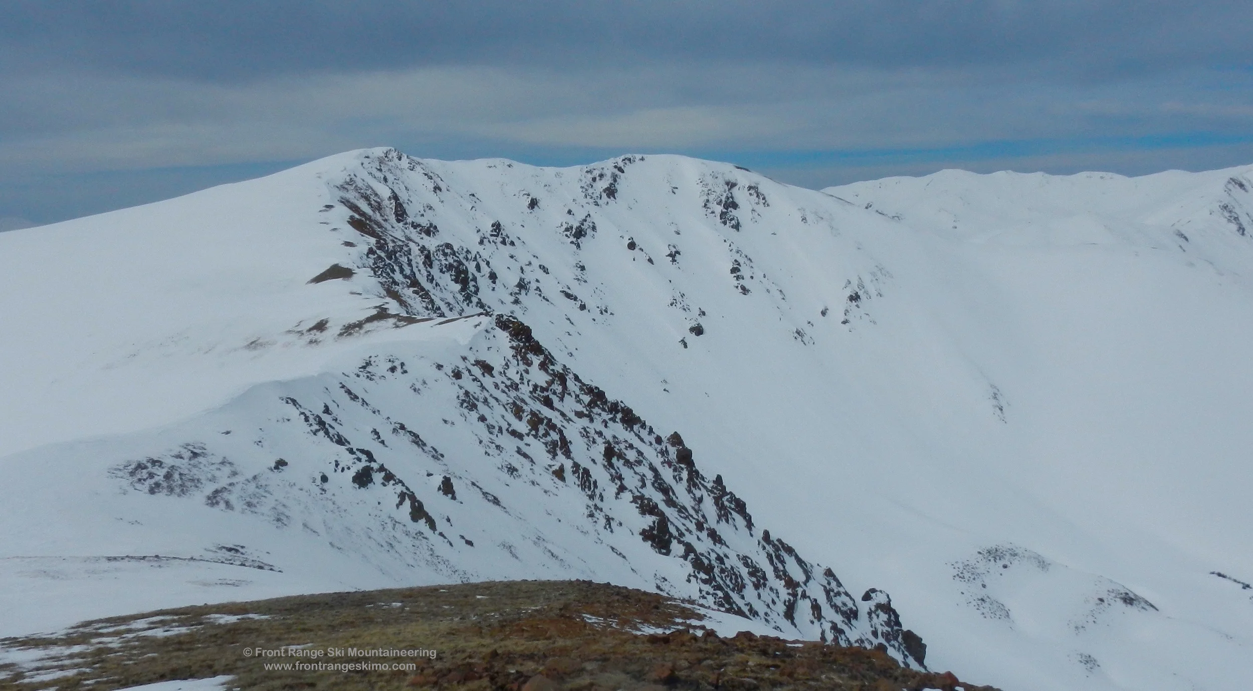
Mount Machebeuf from the Northeast. Photo: Rob Writz
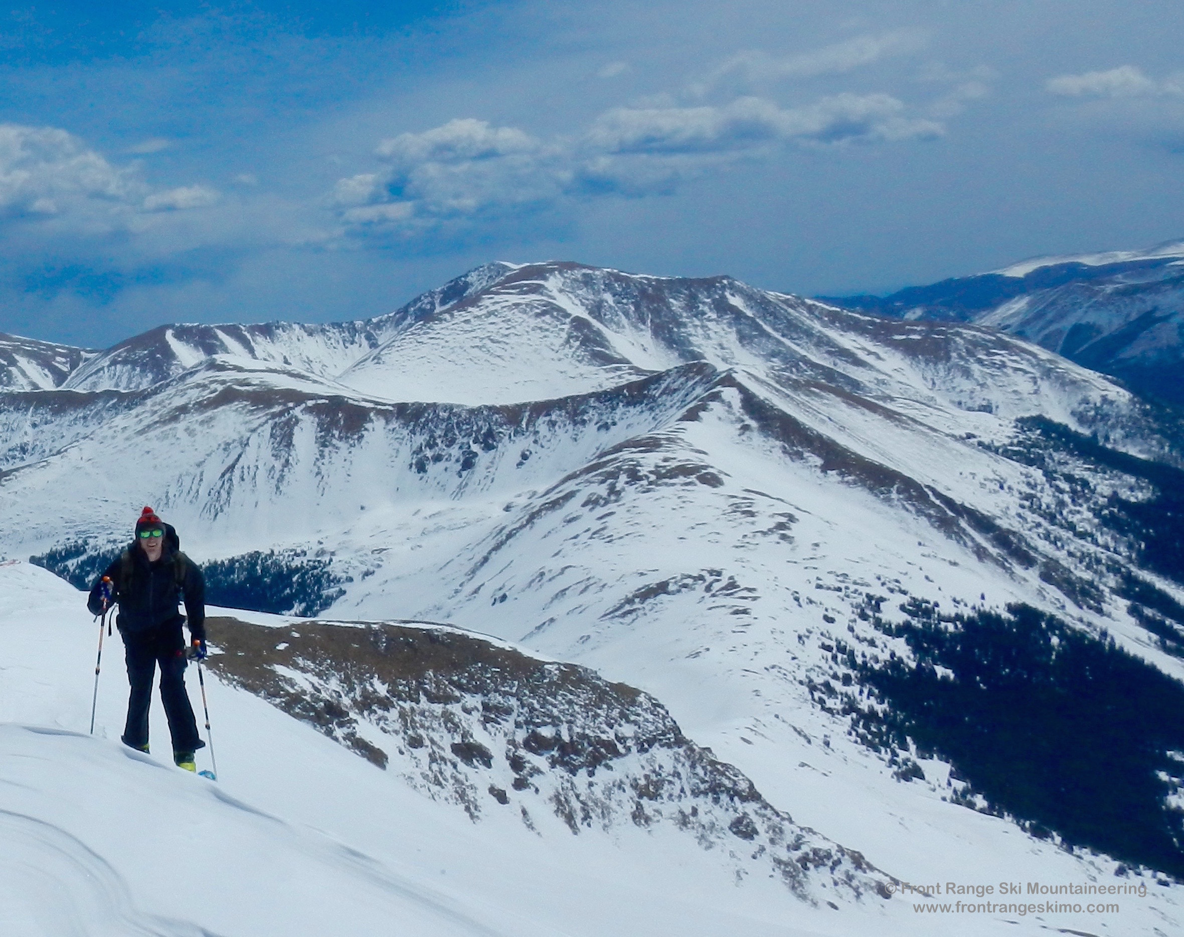
Mount Machebeuf, or Point 12,805’, is the high point between Herman Gulch and Watrous Gulch. Mount Machebeuf is a good mountain for the ski mountaineer who wants to have a quick climb and moderate ski descent with easy access from Interstate 70. The North Bowl has a much longer approach from Herman Gulch and you will need to budget time for climbing back out from this basin.
+ ROUTES
1 – East Bowl
- Rating: II D2
- Season: Spring
- Exposure: East
- Vertical: 1,300’
- Approach Elevations: 10,300’ – 12,805’
- Approach Distance: From Herman Gulch TH: 2.85 Miles
- Top of Route Waypoint: 39.7212, -105.857
The East Bowl of Mount Machebeuf is a low angled slope that is connected to the Watrous Bowl on Woods Mountain. This expansive bowl has numerous options for ascent and descent, and it is a great place for a beginning ski mountaineer. The approach is just long enough to escape the bustle of the highway, and the summit is attainable via the low angle snow slopes. The trees at the bottom of the bowl can be fun skiing in the winter.
Depart the Herman Gulch Trailhead on the well-defined trail by the information kiosk. Within a few hundred yards the trail splits with the left going to Herman Gulch and the right to Watrous Gulch. Go right to Watrous Gulch. The trail to Watrous Gulch is often dry and you may be carrying your skis or snowboard. The trail has been logged extensively due to beetle kill pine and you get good views to Mount Sniktau and Mount Trelease. The trail climbs about 2 miles to tree line. You will probably encounter snow below this, and Watrous Gulch has easy skinning terrain along the creek. As you near tree line turn left and head directly west into the East Bowls.
2 – South Gullies
- Rating: II D6, D4
- Season: Spring
- Exposure: Southwest
- Vertical: 1,400’ – 1,800’
- Approach Elevations: 10,300’ – 12,805’
- Approach Distance: From Herman Gulch TH: 1.4 – 1.8 Miles
- Top of Route Waypoint: South Gully - 39.7212, -105.857, Roadside Distraction - 39.7183, -105.8505
These leeward slopes haul in winter snow, but the South Gullies come into skiing shape in the spring. The South Gully(D6) descends from just west of the summit, while the other another option is located further east and lower on the mountain. This gully is sometimes called “Roadside Distraction” or "Y Gully" (D4) as it is easily visible when driving east on Interstate 70 after Loveland Pass.
Follow the start of the East Bowl approach described above. At the split, turn left and go into to Herman Gulch. The trail reaches a flat terrain at 10,750’. The trail itself may disappear under the snow, and you can skin or snowshoe along the base of the valley. The base of Roadside Distraction is reached at approximately 0.85 miles, and the South Gully at 1.25 miles. Climb the gullies to the summit.

3 – North Face
- Rating: II D8
- Season: Spring
- Exposure: North
- Vertical: 1,800’
- Approach Elevations: 10,300’ – 12,805’
- Approach Distance: From Herman Gulch TH: 4.5 Miles
- Top of Route Waypoint: 39.7212, -105.857
The North Face is a classic cirque shape with several options for snow climbing and skiing. Two prominent lines are just west of the summit, and from the top of the western point of the summit ridge. The eastern side of the cirque is wind blasted and it is not common for this area to be skiable.
There are two options for accessing the North Bowl. One way is to skin up Herman Gulch to the divide separating the Gulch from Woods Creek. From the Herman Gulch Trailhead find the start of the trail on the north side of the parking lot. Follow the trail east for a few minutes to a fork where the Watrous Gulch Trail continues east and Herman Gulch goes west. Take the Herman Gulch trail. The trail reaches a flat terrain at 10,750’. If there is enough snow for skinning you can deviate from the trail and follow the line of the creek up the wide and flat valley about 2.5 miles to 11,400’. [39.72, -105.8826]. Climb north through the forest to 12,000' on the ridge separating Herman Gulch and Woods Creek (about 3 miles from the trailhead). This is a great view point. Traverse about 1.3 more miles around the north flanks of the mountain to the base of the cirque. Climb your chosen route from here.
The other option is to follow the moderate approach via Watrous Gulch and the East Bowl for a full tour of Mount Machebeuf. This option results in having to climb out of Woods Creek to the ridge separating the valley from Herman Gulch. It is a 6.5 mile round trip, and you are at a higher risk of not having climbed your descent route first.
+ TRAILHEAD
Herman Gulch Trailhead (10,300’)
Herman Gulch Trailhead is located on exit 218 on Interstate 70. This is west of Bakersville and east of Loveland Pass. There is a massive parking lot on the north side of the exit with an information kiosk and outhouses. The Herman Gulch trail starts near the kiosk by the outhouses. [39.7024, -105.8545]
+ MAPS & PICTURES
Below we have included a link to a Google interactive map and a curated list of photos of the mountain.

Clicking on map above will open interactive Google map website