Cherokee 12,180'
Cherokee from the north. Photo: Rob Writz
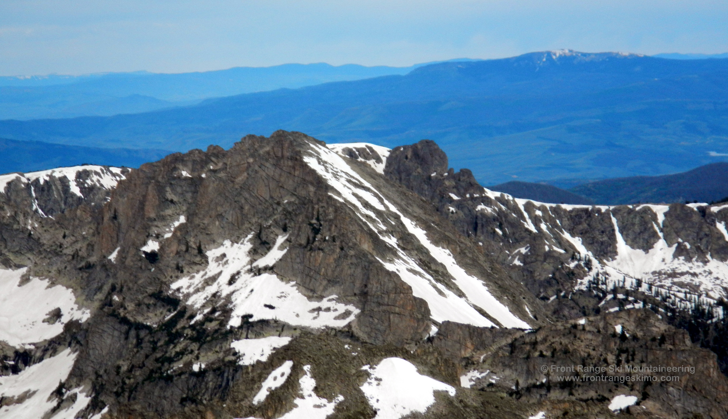
Cherokee guards the west entrance into the Lone Eagle Cirque. It is the peak furthest north in the Cirque, and it is the terminus of the West Rim of the cirque. Cherokee greets ski mountaineers approaching on the Cascade Creek trail with a glimpse of what is to come. The Northeast face line can be viewed from several vantages during the hike in. The bowl and ridges north and west of Cherokee have huge towers, steep couloirs, and are the new frontier of Lone Eagle ski mountaineering.
+ ROUTES
Route 1 - Northeast Face
- Rating: IV* D8
- Season: Spring
- Exposure: Northeast
- Vertical: 1,800'
- Approach Elevations: 8,340’ - 12,180’
- Approach Distance: From Mirror Lake: 2 miles, From Monarch Lake TH: 6.6 Miles
The Northeast Face line appears intimidating, but it is not as steep as it looks. The majority of the difficulty is crossing the valley from the Cascade Creek Trail and climbing where you head up the drainage below the north side of Cherokee. The route itself is of high quality, but does not last as long in the season as the permanent snowfields of the Lone Eagle Cirque do. It is skiable into June. The lower portion of the route has some rocks that expose early on, and as the season transitions to summer the upper gully forms into several variations. The view from the diminutive summit into the Peck Glacier is spectacular.
*This is a grade II route from a high camp in the Lone Eagle Cirque or from points on the Cascade Creek or Crater Lake Trails.
From the Monarch Lake Trailhead follow the Cascade Creek Trail east across the north side of Monarch Lake. The trail continues eastward 3.1 miles to the intersection with the Buchanan Pass Trail. Hike on the Cascade Creek Trail to the southeast 2.7 miles to the junction with the Pawnee Pass Trail and Crater Lake Trail. Cross Pawnee Creek and go south on the Crater Lake Trail, and within a half mile look for a camping spot to the east (left) in lower angle and sometimes dry terrain. There is often snow at Crater Lake, and this positions north and east of Mirror Lake are good for a basecamp. From this area it is about a quarter mile southwest to Mirror Lake and then a quick jaunt to Crater Lake.
From the Mirror Lake area, backtrack on the approach described above to the junction of the Pawnee Pass, Cascade Creek, and Crater Lake trails. There are several vantages in this area where you can get a view of the Northeast Face of Cherokee. Note the steep rock slabs that are guarding the north side of Cherokee. Your goal is bypass these slabs by going back down the Cascade Trail about a quarter mile from the trail junction, and then leave the trail and bushwhack south to find the creek outlet from the basin north of Cherokee. This is where the climbing begins straight up to 10,400’ feet. The climber’s right side of the creek is open for a previous slide, but the creek has a small gorge that you will need to negotiate to get to the route. If you go up climber’s left of the creek, you will quickly reach an open slide area left side of the creek and can follow this towards the north facing ramp that eventually curves climber’s right into the small gully that is the Northeast Face route.
+ TRAILHEAD
Monarch Lake Trailhead (8,340’)
Monarch Lake Trailhead is on the west side of the Continental Divide east of Grand Lake and the town of Granby. From the town of Granby, drive north on Highway 34 to Lake Granby’s Rainbow Bay and turn east on County Road 6 towards Arapaho Bay. Follow this about 10 miles east to the Monarch Lake Trailhead.
This trailhead is in the Arapaho National Recreation Area. There is a $5 per day vehicle fee and you can learn more about it at the ANRA website. Additionally, a wilderness permit is required for camping in the Indian Peaks Wilderness. The Arapaho and Roosevelt National Forest website has more information on this. The Sulfur Ranger District headquarters in Granby is a good central location for information on the recreation area and the wilderness area.
+ MAPS & PICTURES
Below we have included a link to a Google interactive map and a curated list of photos of the mountain.

Clicking on map above will open interactive Google map website